Jinnah International Airport is Pakistan’s largest International and Domestic airport. It is located in Karachi, Sindh and it’s passenger terminal is commonly referred to as Jinnah Terminal. The airport is named after Muhammad Ali Jinnah, the founder of Pakistan and it’s first Governor General.
The airport acts as a primary hub for Pakistan International Airlines, Shaheen Air International, AirBlue and Serene Air. The airport is equipped with aircraft engineering and overhauling facilities including the Ispahani Hangar for wide-body aircraft.
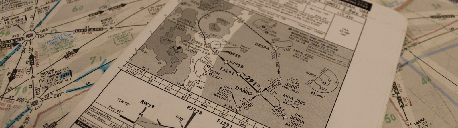
The airport has two runways, one is 11,155 feet and other is 10,500 feet long. Runways 25R/07L and 25L/07R are each approximately 150 feet wide. The runways have the capacity to handle 15 flights per hour. Runway 07L/25R is equipped with an ILS to guide landing aircraft safely under poor weather conditions, such as fog. The taxiway is able to handle 12 aircraft at a time while the parking area for aircraft is 266,000 square meters where 42 aircraft can be parked and 12 with contact gates. In addition, there is remote parking bay for 30 aircraft.
Jinnah International Airport is blessed with clear skies and good weather for most of the year. This makes it an ideal facility for flight training.
Nearby Navigation Aids
| Type |
ID |
Name |
Frequency |
Radial/Bearing |
Range |
| VOR-DME |
KC |
Karachi |
112.10 |
258 |
1.0 NM |
| VORTAC |
MR |
Karachi Masroor |
112.40 |
086 |
086 |
| VOR-DME |
NH |
Nawabshah |
112.90 |
219 |
102.6 NM |
| VOR-DME |
BHU |
Bhuj |
112.60 |
306 |
168.7 NM |
| NDB |
KC |
Karachi |
271 |
350 |
0.9 NM |
| NDB |
KO |
Karachi |
235 |
074 |
4.8 NM |
| NDB |
MR |
Karachi Masroor |
354 |
276 |
12.6 NM |
| NDB |
KF |
Gharo |
296 |
108 |
23.3 NM |